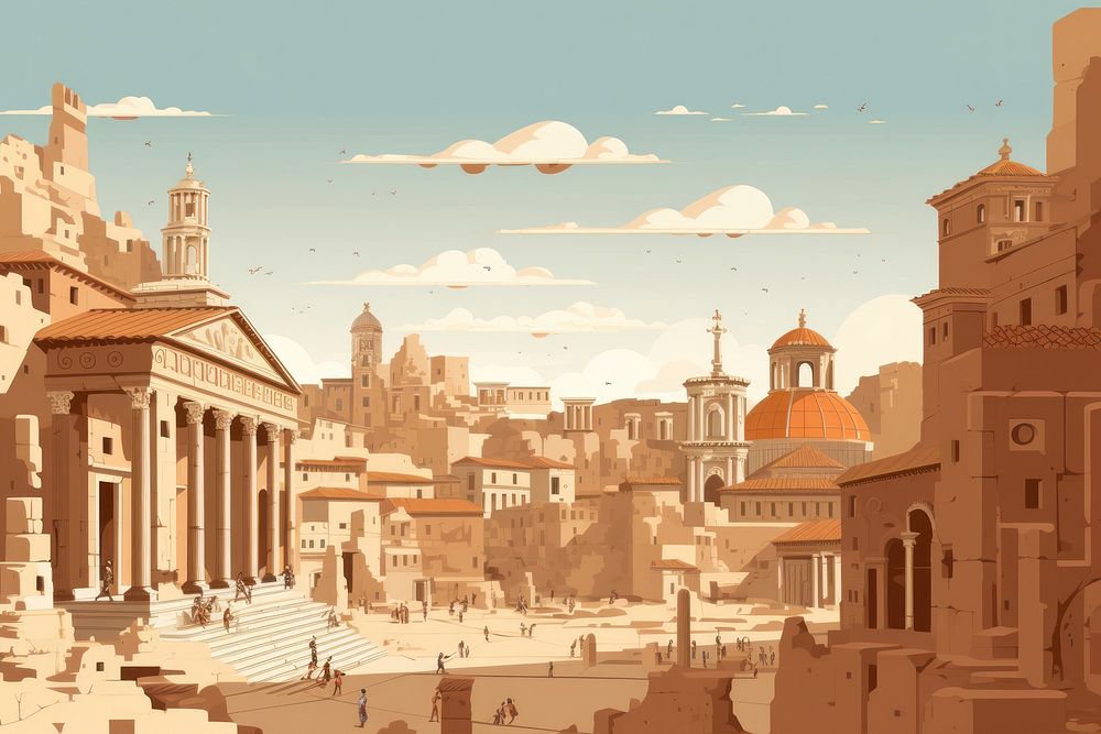
The layout of a Roman city was rarely random. Across the Roman Empire, cities were often planned around a clear system of roads, public buildings, religious spaces, markets, and residential areas. Although Roman cities could look very different depending on when and where they were built, many followed similar principles that helped organize large populations and made cities easier to govern.
At the heart of many Roman cities was the forum, a large public space that served as the political, religious, and commercial center of urban life. Important buildings such as temples, basilicas, government offices, and marketplaces were often located around or close to the forum. From here, major roads connected different parts of the city and linked the settlement to the wider Roman road network.
Many Roman cities also used a grid-like street plan, with roads running roughly north-south and east-west. Two major streets were particularly important: the cardo, which generally ran north to south, and the decumanus, which generally ran east to west. Their intersection often formed an important point within the city. This system made movement, construction, administration, and the division of land easier.
The reasons behind this layout were both practical and political. Roman planners needed to organize growing populations, provide access to important public buildings, move goods efficiently, and create systems for water, drainage, and waste. Cities also needed roads large enough to connect their gates with important destinations inside and outside the settlement.
Military planning played an important role as well. Many Roman towns developed from military forts or settlements established by the Roman army. The organized layout used by Roman camps could therefore influence the design of permanent towns and colonies. Even cities that were not originally military settlements could adopt similar planning principles.
However, not every Roman city followed a perfect grid. Older settlements often had irregular streets because Roman planners had to work with existing buildings, hills, rivers, coastlines, and roads. Rome itself was an extreme example, developing over centuries rather than being designed according to one unified plan.
Understanding the layout of a Roman city therefore reveals much more than where its buildings stood. It shows how the Romans thought about transport, government, religion, trade, public life, sanitation, and military organization. The city was designed not simply as a collection of buildings, but as an interconnected system that allowed Roman urban life to function.
1. The Forum: The Heart of a Roman City
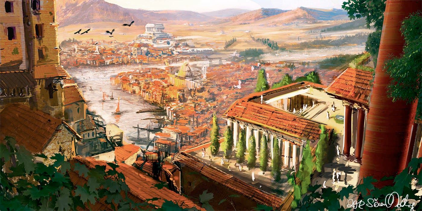
At the center of many Roman cities was the forum, the most important public space in the city. It was much more than an open square. The forum was where politics, religion, business, law, and public life came together, making it one of the most important features of Roman urban planning.
The forum was often positioned in a central and accessible location, allowing people from different parts of the city to reach it easily. Major roads could lead toward the forum, connecting it with the city gates, residential neighborhoods, markets, and other important buildings. In planned Roman settlements, the forum was often incorporated into the wider street grid, making it an essential part of the city’s overall layout.
One of the most important buildings around the forum was the basilica. Despite the later Christian meaning of the word, Roman basilicas were originally large public buildings used for legal cases, business, administration, and meetings. Their position close to the forum reflected the importance of law and government in Roman urban life.
Temples were also commonly located around the forum. Religion was closely connected with Roman government and public life, so important temples could stand alongside administrative and commercial buildings. These structures could be dedicated to major Roman gods, the emperor, or important local deities. Their prominent positions also made religion highly visible within the city.
The forum could also contain statues, monuments, inscriptions, and public memorials. These helped communicate important messages about Roman power, local officials, military victories, and loyalty to the emperor. The appearance of the forum therefore served a political purpose as well as a practical one.
The forum was also an important place for commerce and everyday interaction. Shops and businesses could operate around the surrounding streets, while markets and traders brought goods into the center of the city. Citizens could meet other people, conduct business, attend public events, or simply pass through the busiest part of the settlement.
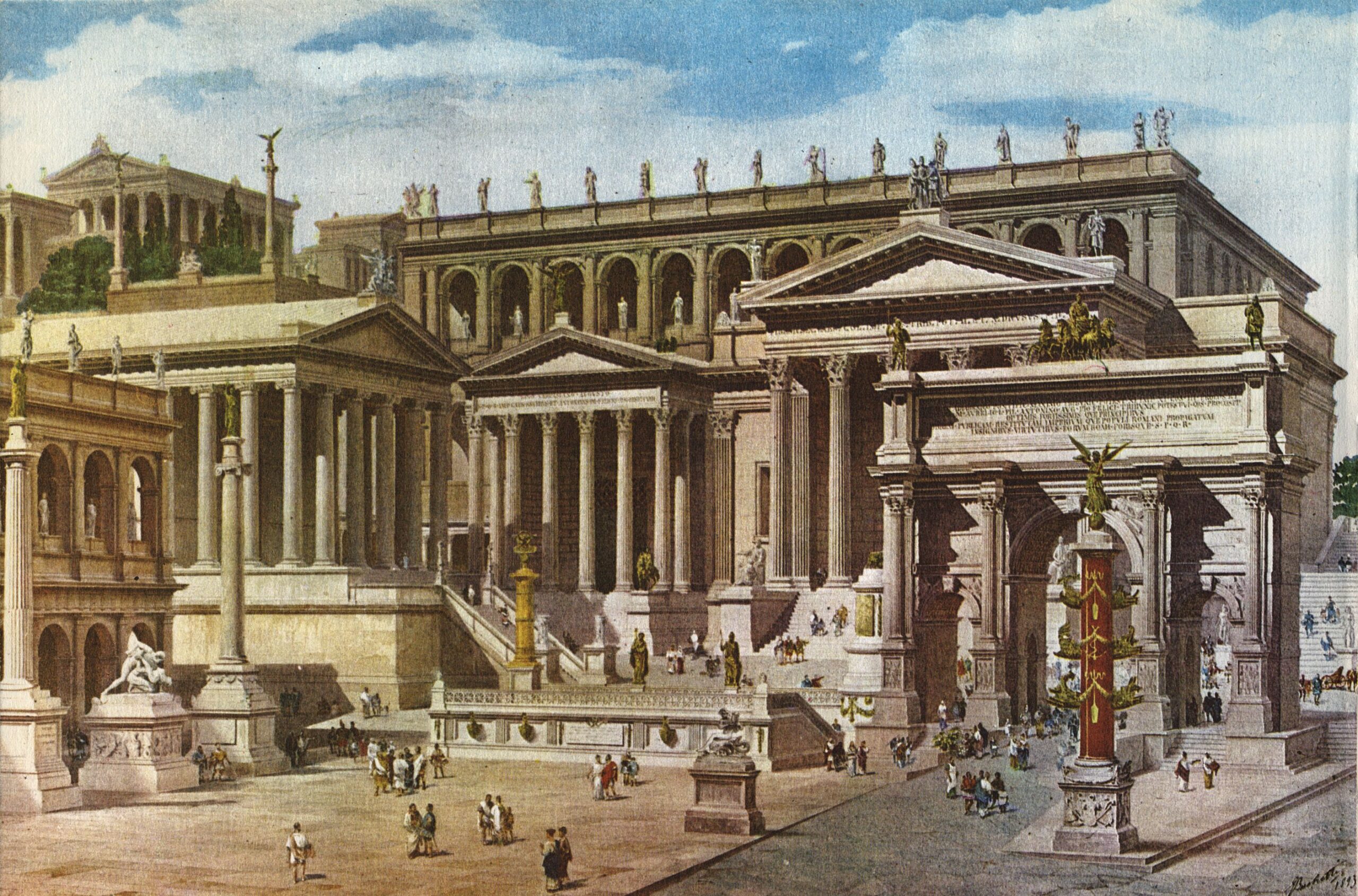
The design of the forum also demonstrated the wealth and importance of a city. Large colonnades, temples, basilicas, paved surfaces, statues, and monuments created an impressive public environment. Wealthier and more important cities could invest enormous resources into their forums, turning them into symbols of Roman civilization and local prosperity.
However, not every Roman city had a forum that looked exactly the same. Older settlements often had to adapt their public spaces to existing streets, hills, rivers, and buildings. Newly planned colonies could follow a much more organized design, while cities that had existed before Roman rule sometimes developed more irregular layouts.
The forum was therefore not simply the center of a Roman city geographically. It was the social, political, religious, and administrative center around which much of urban life revolved. Understanding the forum helps explain why Roman cities were organized the way they were: the city needed a central space where its most important activities could come together.
5 Key Ideas
- The forum was the central public space of many Roman cities.
- It brought together politics, religion, law, business, and social life.
- Important buildings such as basilicas and temples were often built around it.
- Forums also displayed Roman power, wealth, and political authority.
- The forum played a major role in determining the overall layout and organization of the city.
2. The Main Streets: The Cardo and Decumanus
The streets of a Roman city were carefully organized to connect the most important parts of the settlement. In many planned Roman cities, the street system followed a grid pattern, with roads running in two main directions. This approach made the city easier to navigate, helped officials organize land, and provided efficient routes for people, soldiers, and goods.
Two roads were particularly important: the cardo maximus and the decumanus maximus. The cardo generally ran north to south, while the decumanus generally ran east to west. These were normally among the largest and most important streets in the city. They could connect major city gates with the central area, making them important routes for movement and trade.
The intersection of the cardo and decumanus was particularly significant. In many planned settlements, this area was located close to the forum or connected directly with it. This created a logical structure in which the city’s major roads, public buildings, and administrative center were closely connected.
The grid system had important practical advantages. It allowed Roman planners to divide land into organized blocks, making it easier to determine where houses, shops, workshops, public buildings, and other structures could be constructed. Instead of allowing buildings to develop completely randomly, planners could create a framework that controlled the expansion of the settlement.
The streets also played an important role in transport and trade. Wagons carrying food, building materials, pottery, agricultural products, and other goods needed reliable routes through the city. Major roads connected the city center with the gates, while smaller streets provided access to individual neighborhoods.
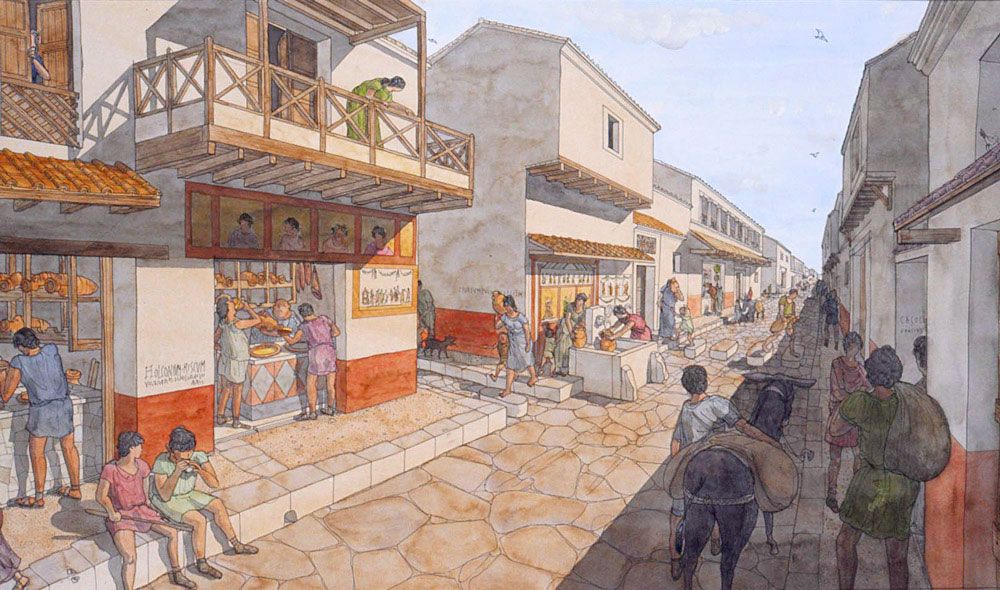
Roman streets were often constructed with considerable engineering skill. Major roads could have paved surfaces, raised sidewalks, drainage systems, and carefully constructed foundations. In some cities, stepping stones were placed across roads so pedestrians could cross without stepping directly into the roadway or water flowing through it.
The width and quality of streets could vary considerably. Important roads were generally wider and better constructed, while smaller residential streets could be narrower. Some streets were also affected by the local environment. Hills, rivers, coastlines, and existing settlements could force Roman planners to modify the ideal grid.
This is why it is important not to imagine every Roman city as a perfect checkerboard. The grid system was a planning principle, not an absolute rule. Cities such as Rome developed gradually over centuries and had much more complicated street patterns. Other cities, particularly newly founded colonies and settlements influenced by military planning, could follow a much more regular design.
The Roman street system was also connected to the wider Roman road network. Roads leading through the city could continue beyond its walls and connect the settlement with neighboring towns, military bases, ports, and provincial capitals. This meant that the city was not isolated from the surrounding countryside. Its streets formed part of a much larger transportation system covering the Roman Empire.
The organization of streets therefore had both practical and administrative purposes. Roman planners needed cities where people and goods could move efficiently, property could be organized, and important public buildings could be reached easily. The cardo and decumanus provided a simple framework that helped achieve these goals.
5 Key Ideas
- Roman cities often used a grid-based street system.
- The cardo generally ran north-south, while the decumanus ran east-west.
- Major roads connected the forum, city gates, neighborhoods, and surrounding roads.
- Streets helped organize transport, trade, property, and urban expansion.
- Roman cities did not always follow a perfect grid because terrain and existing settlements influenced their design.
3. City Gates and Walls: Controlling Access to the City
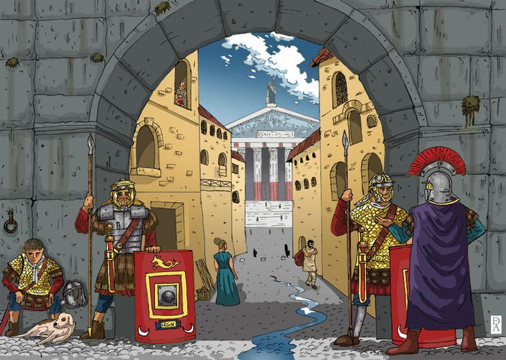
The city walls and gates were another important part of Roman urban planning. They were not simply defensive structures. The walls helped define the physical boundaries of the city, while the gates controlled movement between the city and the surrounding countryside. Their position also influenced the way roads entered the city and connected with the wider Roman road network.
Roman cities often had several major gates positioned around their walls. These gates were normally connected to the most important roads inside the city. A major road approaching from outside could pass through a city gate and continue toward the forum or central districts. This created a direct connection between the city and the surrounding territory.
The location of the gates was therefore carefully considered. Planners needed to provide convenient access for travelers, merchants, soldiers, and local residents while also maintaining control over who and what entered the city. A well-positioned gate could connect the city to an important road leading toward another settlement, military base, port, or agricultural area.
The walls themselves could vary greatly depending on the city. Some settlements had substantial stone fortifications, while others had less impressive defenses or relied partly on natural features such as rivers, steep hills, or coastlines. The importance of a city’s location and its perceived military threat could influence how much effort was invested in its defenses.
In some cities, the walls were constructed from large blocks of stone, brick, or concrete and could include towers, defensive platforms, and fortified gateways. Gates could become impressive architectural features in their own right. They demonstrated that the city was protected while also creating a formal entrance that reflected its importance.
The walls also had an important administrative function. They established a clear boundary between the urban area and the land outside it. Inside the walls were the city’s major buildings, homes, workshops, markets, and public spaces. Outside were roads, farms, cemeteries, villas, and other settlements that formed part of the wider landscape.
This distinction was not always absolute. Roman cities could expand beyond their original walls, and some urban areas developed outside the formal boundaries. Nevertheless, the walls provided an important framework for understanding where the city officially began and ended.
The relationship between gates, roads, and the forum was particularly important. A person entering through one of the main gates could often follow a major road toward the center of the city. This meant that visitors were naturally directed toward important public areas. The layout also made it easier for officials to control movement through the city.
City gates could also have a strong symbolic purpose. Entering through a monumental gateway could make a city appear wealthy, organized, and powerful. In important Roman settlements, the entrance could feature arches, inscriptions, statues, or other decorative elements that communicated the city’s identity and connection to Roman authority.
The defensive layout of a Roman city also reflected changing conditions across the Empire. During periods of relative stability, some cities could maintain impressive walls that were more symbolic than militarily necessary. In later centuries, when external threats became more serious, many cities strengthened or rebuilt their defenses.
The city walls and gates were therefore an important part of the Roman city layout because they connected the settlement to the outside world while also defining and controlling the urban space within. Together with the main roads, they created a system that allowed people, goods, and information to move efficiently while giving the city a clear and organized structure.
5 Key Ideas
- City walls defined the boundaries of many Roman settlements.
- Major gates connected Roman cities to roads and the surrounding countryside.
- Roads entering through the gates often led toward the city center and forum.
- Gates could serve both practical and symbolic purposes.
- Walls and defenses varied depending on the location, importance, and security needs of each city.
4. Public Buildings: Baths, Theaters, and Amphitheaters
Roman cities were filled with public buildings that served both practical and social purposes. These structures were an important part of the city’s layout because Roman urban life was not centered only on private homes. The Romans believed that a successful city needed spaces where people could bathe, exercise, watch entertainment, conduct business, worship, and gather together.
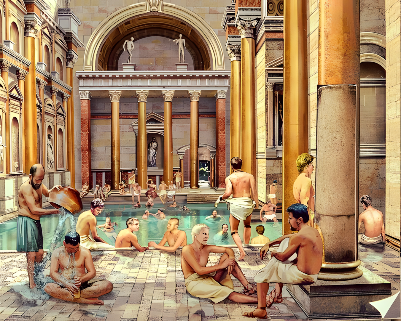
One of the most important types of public building was the Roman bathhouse. Baths could be found in cities of many different sizes and were used by people from a wide range of social backgrounds. Large bath complexes could contain hot rooms, warm rooms, cold rooms, exercise areas, gardens, swimming pools, and meeting spaces. Their location was important because they needed access to water, fuel, roads, and large numbers of visitors.
The public baths also influenced the surrounding neighborhood. Shops and businesses could develop nearby because bathhouses attracted large numbers of people every day. In major cities, enormous bath complexes could occupy substantial areas and become important landmarks.
Another important building was the theater. Roman theaters provided spaces for performances, festivals, and public entertainment. They were usually designed with a semicircular seating arrangement facing a stage. Their architecture allowed large crowds to watch performances while also creating an impressive public environment.
The amphitheater served a different purpose. These large oval structures were designed to accommodate crowds watching public spectacles. The most famous example is the Colosseum in Rome, but amphitheaters were constructed throughout the Roman Empire. Their locations were often carefully chosen so that large numbers of people could reach them from different parts of the city.
The size of these buildings tells us something important about Roman urban planning. Romans had to think about crowd movement when designing public spaces. Roads leading toward large buildings needed to accommodate thousands of people, while entrances, exits, stairways, and surrounding spaces had to help control the movement of crowds.
Public buildings could also communicate political power. Wealthy officials and emperors sometimes funded enormous construction projects to gain popularity and demonstrate their generosity. Buildings could carry inscriptions identifying the person who financed or restored them. This meant that architecture became a way of displaying wealth, status, and loyalty to Rome.
Their locations were therefore rarely accidental. A bathhouse might be positioned where it could receive a reliable water supply. A theater or amphitheater needed enough space for the structure and the crowds around it. Important public buildings were often connected by major roads, allowing people to move between different parts of the city.
Not every Roman city had all of these buildings. Smaller towns might have a modest bathhouse and theater, while major provincial centers could contain multiple baths, theaters, amphitheaters, temples, basilicas, and other public structures.
These buildings helped turn Roman cities into places where people could participate in a shared urban culture. They were not simply decorations. They were carefully integrated into the city’s infrastructure and helped determine how people moved through and experienced the city.
5 Key Ideas
- Roman cities contained many public buildings designed for everyday life and entertainment.
- Baths, theaters, and amphitheaters were important centers of urban activity.
- Their locations were influenced by water, roads, available space, and crowd movement.
- Public buildings could demonstrate Roman wealth, power, and political influence.
- The size and number of public buildings often reflected the importance and population of a city.
5. Residential Areas: Houses, Apartments, and Neighborhoods
While the forum and public buildings formed the center of Roman urban life, most people spent much of their time in the residential areas surrounding them. Roman cities contained a mixture of private houses, apartment buildings, shops, workshops, and smaller streets, creating neighborhoods that could be very different depending on the wealth and status of their residents.
Wealthier Romans often lived in large private houses called domus. These homes were commonly organized around an internal courtyard or atrium, with rooms arranged around the central space. Some larger houses also had gardens, dining rooms, private baths, and decorated courtyards. Their position within the city could reflect the owner’s wealth and social importance.
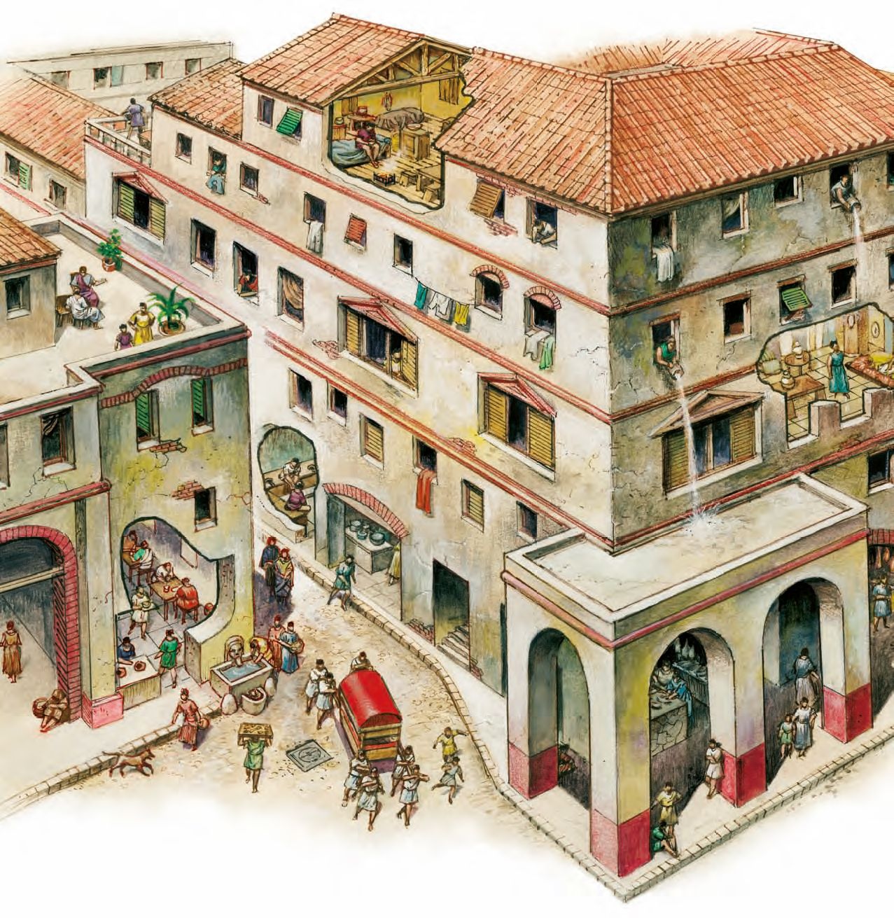
Many ordinary residents, however, lived in insulae, multi-story apartment buildings that were especially common in large and densely populated cities. Rome itself had enormous numbers of apartment buildings because the population was too large for everyone to live in individual houses. Insulae could contain several floors and a mixture of apartments, shops, and workshops.
The layout of residential neighborhoods was closely connected to the street system. Houses and apartment buildings were generally built along the roads, creating blocks of urban development. Shops often opened directly onto the street, allowing businesses to interact with pedestrians and customers. A single building could therefore combine several different functions.
For example, the ground floor might contain a shop or workshop, while the upper floors were used as living spaces. This made Roman neighborhoods active places throughout the day. People could live, work, shop, and socialize within a relatively small area.
The quality of housing varied enormously. Wealthy families could own spacious houses with decorated walls, mosaics, fountains, gardens, and private facilities. Poorer residents might live in much smaller apartments with fewer comforts. This meant that the appearance of a Roman neighborhood could reveal significant differences in wealth and social status.
Residential areas were also influenced by the geography of the city. In a flat, newly planned settlement, houses could fit neatly into the urban grid. In older cities or settlements built on hills, streets and buildings had to adapt to the landscape. This helps explain why not every Roman city looked perfectly organized.
The location of housing could also depend on proximity to important parts of the city. Wealthy residents might prefer areas close to the forum and major public buildings, while workers and traders could live near workshops, markets, or transport routes. Some neighborhoods could become associated with particular trades or communities.
Roman planners also had to consider fire, sanitation, and access to water. Dense apartment buildings could create serious risks, especially in large cities. Narrow streets and closely packed structures made fires difficult to control. Access to water and drainage was therefore an important part of urban planning.
Residential neighborhoods demonstrate that a Roman city was not simply a collection of impressive monuments. Behind the temples, forums, baths, and amphitheaters was a huge population living in organized urban communities. Their homes were connected to the same roads, water systems, markets, and public spaces that made the wider city function.
The arrangement of residential areas therefore reflected the social structure of Roman society. The differences between wealthy domus and crowded insulae show how Roman cities brought people of very different economic backgrounds into the same urban environment.
5 Key Ideas
- Roman residential areas contained domus, insulae, shops, and workshops.
- Wealthy Romans often lived in large private houses, while many ordinary residents lived in apartments.
- Shops and workshops were frequently built directly onto residential streets.
- Housing reflected major differences in wealth and social status.
- Residential neighborhoods were connected to the city’s roads, water supply, markets, and public buildings.
6. Water, Drainage, and Sanitation: Keeping the City Running
A Roman city could not function without a reliable supply of fresh water and effective drainage. Behind the impressive temples, forums, baths, and houses was a complex network of infrastructure that brought water into the city, distributed it to different neighborhoods, and removed wastewater and rainwater. These systems were among the most important parts of Roman urban planning because a large population could not survive without a dependable water supply.
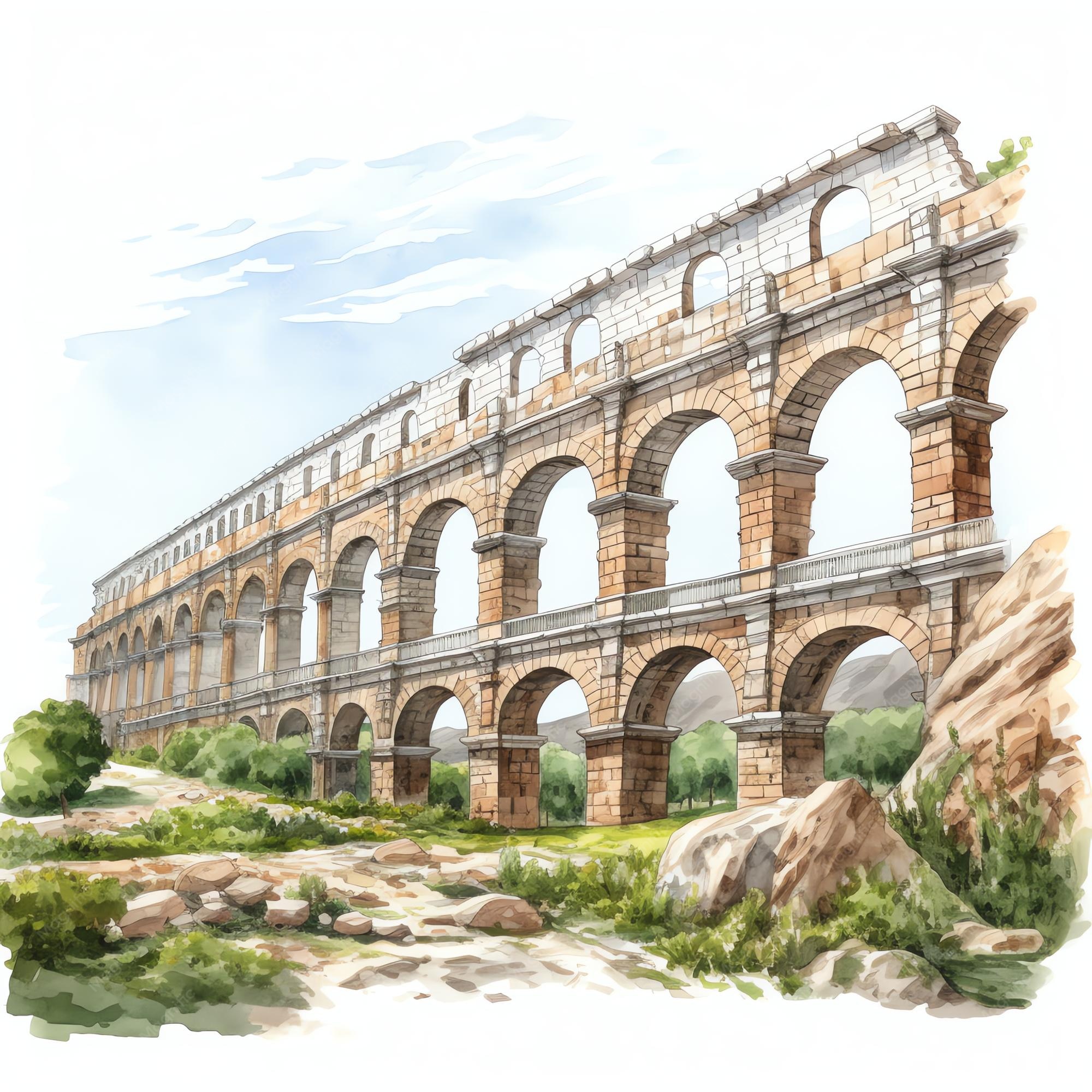
Many major Roman cities received water through aqueducts, which transported water from springs, rivers, lakes, or other sources outside the city. Roman engineers carefully planned the route of an aqueduct so that water could flow downhill using gravity. Although some aqueducts are famous for their enormous stone arches, much of the system could actually run underground or through covered channels.
The route of an aqueduct was carefully chosen because engineers had to maintain a gradual slope over long distances. If the slope was too steep, water could flow too quickly and damage the channel. If it was too shallow, the water might not flow effectively. This required considerable knowledge of surveying, engineering, and construction.
Once water reached the city, it could be directed into large distribution tanks called castella. From there, water was divided between different parts of the urban area. Supplies could be directed toward public fountains, bathhouses, private houses, gardens, workshops, and other buildings.
Public fountains were particularly important because many ordinary residents did not have private water connections. People could collect water from fountains located along streets and in public spaces. Their position was therefore important to the daily life of neighborhoods.
The enormous Roman baths also depended heavily on the water system. Large bath complexes could require huge quantities of water every day for pools, fountains, washing, and other activities. This meant that bathhouses needed reliable access to the city’s water network. Their location and construction therefore had to be considered alongside the wider infrastructure of the city.
Water was also important for industry and commerce. Certain workshops required water for production, cleaning, or processing materials. The availability of water could therefore influence where particular activities developed within the city.
However, bringing water into a city was only half of the problem. Roman planners also had to find ways to remove unwanted water and waste. Streets could become flooded during heavy rainfall, while households, public buildings, and workshops produced wastewater that needed to be carried away.
Roman cities developed a variety of drainage channels, sewers, drains, and cesspits to deal with these problems. Some drainage systems were built beneath streets, while others were incorporated into buildings. Large cities could develop extensive underground networks that carried wastewater away from populated areas.
The most famous example is the Cloaca Maxima in Rome, one of the ancient city’s major drainage systems. It helped carry water and waste away from parts of the city and eventually toward the Tiber River. Although the system developed and changed over many centuries, it demonstrates the importance of drainage to Roman urban life.
Roman streets were also designed with drainage in mind. Paved roads could be slightly raised or shaped so that rainwater flowed toward gutters and drainage channels rather than remaining on the road surface. This was especially important in crowded areas where standing water could make streets difficult to use.
Sanitation in Roman cities was nevertheless very different from modern sanitation. Romans did not have modern water-treatment plants or underground sewage systems connecting every home. Instead, cities used a combination of public latrines, household toilets, cesspits, drains, sewers, and waste collection. The exact system varied considerably from one city and building to another.
Public latrines could contain rows of seats positioned above drainage channels. Some were connected to running water, while other buildings relied on different methods of cleaning and waste removal. Wealthier homes could have private toilets, although these were not necessarily connected to a sophisticated sewer system.
The relationship between water supply and sanitation was also important. A city needed to keep public spaces usable while preventing waste from accumulating in heavily populated areas. Drainage systems therefore became an essential part of the urban environment, even though much of the infrastructure was hidden beneath streets and buildings.
Water infrastructure could also demonstrate the wealth and importance of a city. An impressive aqueduct, large public fountain, or enormous bath complex showed that a city possessed the resources and engineering expertise needed to maintain major infrastructure. Emperors and local officials could gain prestige by financing water projects, and inscriptions sometimes recorded who had paid for or restored them.
The location of water infrastructure also influenced the layout of the city itself. Aqueducts had to enter at suitable points, distribution tanks needed appropriate locations, and major bathhouses required substantial water supplies. Drainage channels and sewers also had to follow practical routes through the urban area.
This meant that the Roman city was dependent on a hidden infrastructure that connected different parts of the settlement. The forum, houses, baths, workshops, fountains, and streets all relied on systems that were often underground or outside the city walls.
Water, drainage, and sanitation therefore played a fundamental role in Roman urban planning. They allowed cities to support large populations, maintain public buildings, encourage economic activity, and keep streets and public spaces functioning. Although Roman sanitation was not modern, their ability to design large-scale water and drainage networks was one of the most impressive aspects of Roman engineering.
5 Key Ideas
- Aqueducts transported fresh water from distant sources into Roman cities.
- Water was distributed to fountains, baths, houses, workshops, and gardens.
- Drains and sewers helped remove rainwater and wastewater from crowded urban areas.
- Roman sanitation relied on public latrines, private toilets, cesspits, drains, and sewers.
- Water and sanitation infrastructure strongly influenced the layout and development of Roman cities.
7. Why Roman Cities Were Designed This Way
The layout of a Roman city was not simply the result of placing buildings wherever there was available space. In many cases, Roman planners were working toward a clear set of goals: making the city easier to move through, govern, supply, defend, and expand. The arrangement of streets, public buildings, houses, water systems, and city gates was therefore closely connected to the way Romans wanted urban life to function.
One of the most important reasons for the organized layout was movement. A large Roman city could contain thousands of residents, merchants, soldiers, officials, and visitors. Major roads provided direct routes between the city gates, forum, markets, public buildings, and residential neighborhoods. Smaller streets then connected these main routes with individual buildings and blocks.
The layout also made government and administration more efficient. The forum provided a central location for political and legal activities, while basilicas and government buildings were placed nearby. This meant that important civic activities were concentrated in one recognizable area. Citizens knew where to go to conduct business, attend legal proceedings, participate in politics, or take part in public ceremonies.
Military organization also influenced Roman urban planning. Many Roman towns developed from military settlements, and the layout of a Roman military camp was highly organized. Roads, gates, headquarters, barracks, and storage buildings were arranged according to a planned system. When settlements developed around former forts, elements of this organization could remain visible in the later city.
Another advantage of planned streets was the ability to divide land into manageable blocks. When Romans established new colonies, planners could determine where houses, shops, public buildings, temples, and other structures would be constructed. This made it easier to distribute land and control the development of the settlement.
The layout also had to support trade and economic activity. Roads connected cities with ports, farms, mines, military bases, and other settlements. Inside the city, markets and shops were positioned along busy routes where customers could easily reach them. Goods entering through the city gates could therefore move toward commercial areas and markets.
The Romans also had to consider water and sanitation. Aqueducts brought water into the city, while fountains distributed it to residents. Large bathhouses required enormous quantities of water, and drains and sewers carried wastewater away. These systems had to work alongside the roads and buildings, meaning that infrastructure was an important part of the city’s original planning.
Roman cities were also designed to display Roman power and culture. Monumental forums, temples, basilicas, theaters, baths, and gateways created impressive urban environments. In the provinces, these buildings could demonstrate that the settlement was part of the wider Roman Empire.
However, Roman planners could not always create a perfect city. Geography often forced them to adapt their plans. Hills, rivers, mountains, coastlines, and existing roads could all affect the layout. Older cities also had streets and buildings that existed before Roman rule, meaning that planners sometimes had to work around structures they could not simply remove.
This explains why Roman cities could look very different from one another. A newly founded colony might have a highly organized grid, while an older settlement could have irregular streets and complicated neighborhoods. Rome itself developed over centuries and was far less regular than many planned provincial cities.
The layout of a Roman city therefore reflected a combination of planning and adaptation. Romans had clear ideas about how a city should function, but they also had to respond to local geography, population, existing buildings, and economic needs.
Ultimately, the Roman city was designed as an interconnected system. The forum provided a civic center, roads allowed movement, public buildings supported social life, residential districts housed the population, and aqueducts and drainage systems provided essential infrastructure. Each part supported the others.
This organization was one of the reasons Roman urban planning became so influential. The Romans did not simply build impressive individual structures. They created entire urban environments designed around transportation, administration, public life, engineering, and commerce. The result was a city that could support a large population while also expressing the power and organization of Roman civilization.
5 Key Ideas
- Roman cities were planned to make movement, government, trade, and administration easier.
- Military planning influenced the design of many Roman settlements.
- Roads, buildings, water systems, and public spaces worked together as an interconnected urban system.
- Monumental architecture helped display Roman power, wealth, and culture.
- Roman planners adapted their designs to local geography, existing settlements, and changing needs.